Getting Started
The TAT is NOT a single track ride with tight sections. It uses public roads and back country roads, both non-pavement and pavement. It does NOT cross any private land or locked gates. If you are using the official and original navigation, you will not have any trouble, unless something drastic has happened overnight and I do not know about it. www.TransAmTrail.com is the address for official navigation.
The TAT is a physical adventure, as riding all day for several days or weeks can become physical. All along the route, there are several people that have invited you to stop at their house, ranch, or place of business. They offer their service, be it water, shade, minor repairs, bed/ breakfast, or tent camping. These individuals are marked on my maps with locations, names, and phone numbers. They will be respectable to you, so ride with respect for them.
I am here to help you plan your adventure, so please feel free to contact me with your thoughts and concerns. A safe adventure through rural America is what the TAT is all about.
Our best to you, the TAT Team
Travel Advisory
Please take notice of these warnings and adjust your travel plans as needed.
It has come to our attention by several sources, including local forestry managers that there are GPS files being distributed claiming to be the Trans-America Trail that are taking riders onto private land in several areas, including the Hofmann Forest in North Carolina.
These GPS Tracks are NOT part of the official Trans-America Trail and are not associated in any way with the official TransAmTrail.com website.
TransAmTrail.com is the exclusive source for Maps, Roll-Charts, and GPS Tracks for navigating the official “Trans-America Trail” AKA: “The Trans-Am Trail “, and “The TAT “.
Riders relying on other sources of navigation are being warned by the authorities that CITATIONS ARE NOW BEING ISSUED in several areas, including the areas between Maysville, NC and Richlands, NC (see map below).
Local officials are pursuing through law enforcement in the proper jurisdiction to have the person or persons responsible for these GPS Tracks to remove these portions of these routes. Officials specifically named a website by “gpsKevin” as the source for the routes taking riders illegally onto private land.
These warnings DO NOT pertain to the official Trans-America Trail navigation, as offered on the official TransAmTrail.com website, as the navigation for the official Trans-America Trail is updated regularly with respect to public and private land use.
GPS Information
If you are just starting with GPS navigation, here are a few suggestions that will take some of the frustration out of the process.
Your choice of GPS unit is dependent on the way you intend to use it, the memory of the unit, and how user friendly the unit will be. When looking at a particular unit, consider the following:
Most of the newer units will have enough memory for this, while the older units may need an additional larger memory card. Learn what your unit will and will not do.
FAQs
1) What is the “best” motorcycle to ride on the Trans-Am Trail?
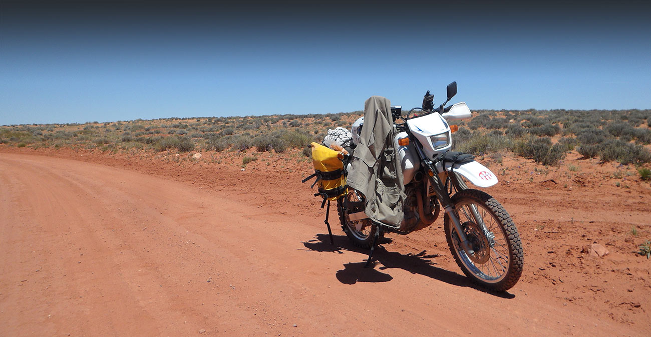
You need a “Dual-Sport” motorcycle that you can handle through deep sand, mud, loose gravel, rocks and snow. It’s important to be sure your motorcycle is in good shape prior to your departure. A tune-up and safety check is a good idea (fresh oil, clean air filter, good tires, correct air pressure, etc.)
2) Does my motorcycle have to be street-legal?
Yes. Your motorcycle MUST be street legal in your home state.
3) When is the best time of the year to ride the Trans-Am Trail?
If you want to cross Colorado, Utah and Oregon, then your snow-window will be late June to early September. Keep in mind the desert heat in Utah and Nevada. Also, snow on the high passes of Colorado usually doesn’t melt enough to allow passage until later in June.
4) Can I ride from West to East?
The TAT Maps and TAT Roll Charts are specifically designed for navigation from East to West, regardless of which state or what part of the trail you decided to start in. My GPS tracks will allow you to navigate East to West.
5) How many miles should I plan to ride each day?
The average days ride is about 200-miles, and that’s a full day from 7AM to 6PM
Gas is plentiful in the eastern sections of the Trans-Am Trail with nothing over 100-miles between available fuel stations, with an average of every 60-miles in-between stations. Several states have 190 miles between available gas. It’s important that you review your TAT-Maps each night, locate the fuel stops on the TAT-Maps and plan your fuel stops for the following days ride. Be aware, if you get a late start and are riding at night, some fuel stations may not be open. When in doubt, be sure to fill up your tank when it reaches a half tank. Many areas of the trail are remote – do not wait until your tank is almost empty before thinking to refuel
If you ride my recommended daily distance, there will be a motel either on the Trans-Am Trail or easy to find just off the trail, each and every night. It is important to locate and plan your overnight stay… do not risk getting caught in the outback after dark. It’s important that you review your TAT-Maps each night, locate the hotels on the TAT-Maps and plan your overnight stay. keeping in mind that you get a late start and are riding at night, some motels may not have vacancy. When in doubt, call ahead and make a reservation. Motels shown on the TAT-Maps are typically modest, yet adequate accommodations such as Super-8, Days Inn, etc.
Many riders prefer to camp when riding the Trans-Am Trail. So for an added sense of adventure, pack your tent and plan to camp. Campgrounds, State Parks and National Parks are NOT listed on the TAT-Roll Charts
9) If I ride the entire Trans-Am Trail, where may I have bike maintenance?
3-Step Hideaway is just a few miles NE of Monticello, Utah. Call Homer at Lake Hill Motors 662-287-4451 to stay at Homer’s Bunkhouse in Corinth, Mississippi. Contact Scott Stevenson at (520) 235-2025 or (435) 249-5567 or visit http://www.3stephideaway.com for needed repair, tire change, camping, cabins, food, and gas. Moab, Utah is about the halfway point of the entire Trans-Am Trail, and an appropriate place to change oil, get new tires or any other repairs or maintenance your motorcycle might need. Contact Fred Hink, owner of Arrowhead Motorsports at 1-435-259-7356 www.arrowheadmotorsports.com. It’s best if you can call ahead to make arrangements… and tell him Sam sent you.
Yes. Knobby tires would be best… but a very good aggressive Dual-Sport tire would be okay in the Eastern sections of the Trans-Am Trail.
No. A GPS unit is NOT required to navigate the Trans-Am Trail, but I recommend one. The main mode of navigation is TAT-Roll Chart/odometer, which is simple, basic and very accurate. A GPS would be added assurance and very good backup.
12) Do I need a Roll Chart holder?
Yes. Get one with a wide and long window so you can view a big section of the TAT-Roll Chart before you have to advance it.
13) What about the TAT-Roll Charts?
The TAT roll charts are 2-1/4 inch wide (the size of adding machine paper). I recommend only loading one day ride at a time, usually from Motel to Motel.
14) Do I need to pack food and water on the motorcycle?
Yes. Pack extra water and bring some food or energy bars. Also, matches and a flashlight would be a very good idea – and an adequate First-Aid kit goes without saying. Hydration systems are recommended – especially important in the arid climates of Colorado, Utah and Nevada. How much water do you need? Experts say you should drink eight ounces of water every 15 minutes during hard exercise. Think of it as four big glasses of water an hour. Remember, temperature affects water intake as well. If it’s hot out, you’ll need more liquid to stay hydrated. “Studies have shown the best way to drink water while you’re exercising is little shots every five minutes,” White says. “If you just gun back a whole water bottle, 20 minutes later you’re just going to pee the whole thing out. It won’t get into your blood.”
15) Are rain gear and warm clothing necessary?
Yes. You must be able to keep dry and warm, even in the summer months. In the high elevations of Colorado, summer temperatures can be cold, even in July and Aug. If caught in the high elevations after dark, the temperatures can drop significantly.
16) What do I need to know about GPS for riding the Trans-Am Trail?
GPS info is a Track, not a Route, and is sent to the rider via email. The rider needs an app or program that can read a GPX file. All states are from border-to-border, across the state. No track is over 500 way-points (poi). A free GPS test file may be requested if needed.
Advice From Sam
Packing for the TAT is a fine line between packing what you might need and packing too much. There are two basic categories for non-vehicle items: camping and motels. Of course, basic items need to be in both categories.
First and foremost is s checklist for your motorcycle, Jeep, truck, or whatever you are driving.
- Have it as fresh as you can. For your motorcycle this means fresh tires and heavy duty tubes. Tire choice should be something that will hook up in mud, gravel, and sand. Remember, there will be some pavement, so give the tire selection some thought. Some have gone the entire crossing on a set of new tires. Others make arrangements for a tire change about midway or before the Colorado section (a personal choice).
- Have a good chain or install a new one.
- Start with new brake pads, fresh oil/ filter, and a clean air filter.
- Have the tools to fix a flat and the tools for minor repairs including basics like a flashlight, matches, zip ties, bungee cords, and duct tape.
I can’t list everything you might need here, but pack as light as you can while bringing what you think you might need. I know it’s hard to do. If you are a camper, then you know the drill. Keep dry and warm at night, and remember that nighttime temps in the mountains are cooler.
- Bring 3 sets of clothes and wash them when you can.
- Bring rain gear, of course, to keep you dry.
- I carry a small umbrella for shade in the desert.

